| Welcome to |
A joint project between |
 |
|
•Main page •Plot Description •Ash in Michigan •Maps •Links •Publications •Personnel •Advisory board •Access for project personnel |
Lower Peninsula Ash Plot Atlas (2009) (4.7 MB PDF)
Upper Peninsula Ash Plot Atlas (2009) (6.8 MB PDF)
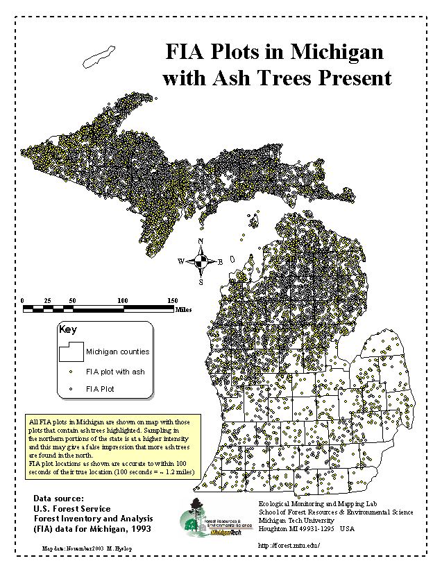
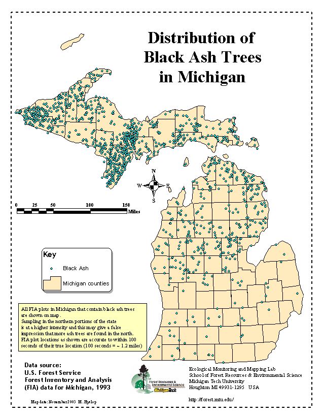
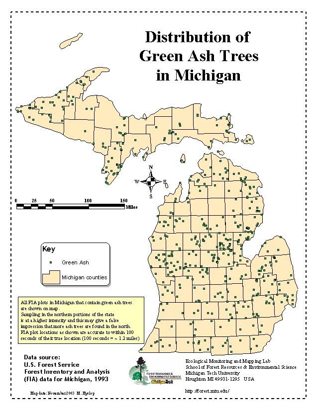
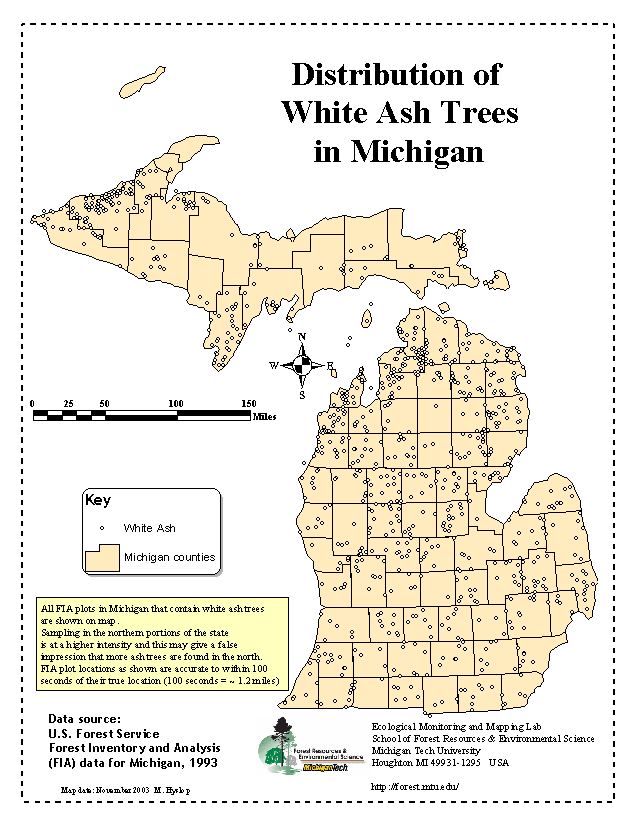
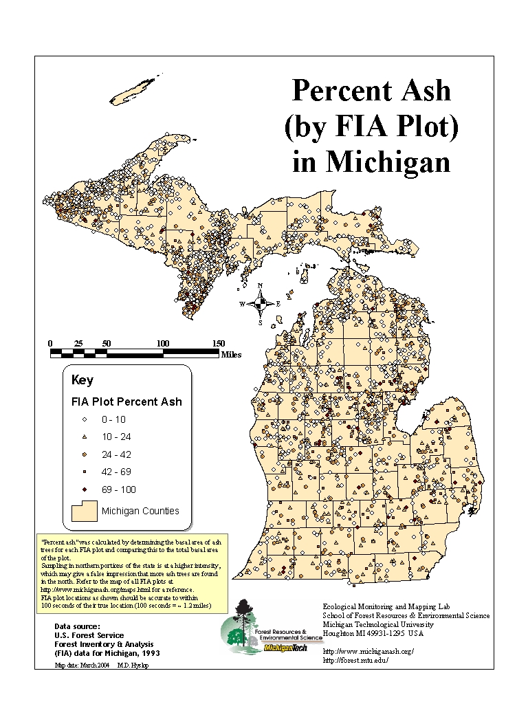
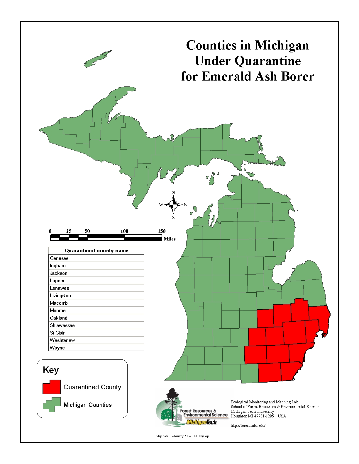
Maps of Ash distribution in Michigan Map of Ash Quarantine Area in Michigan (JPG) (PDF)
|
| School of Forest Resources and Environmental Science Michigan Technological University 1400 Townsend Drive Houghton, MI 49931 (906) 487-3470 ces@mtu.edu |
Copyright © 2004-2009 Center for Exotic Species (CES) |